Filter by

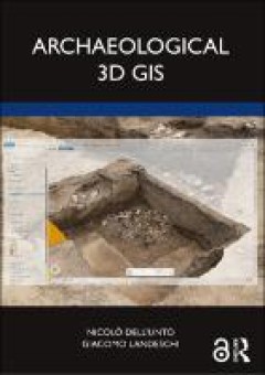
Archaeological 3d GIS
Archaeological 3D GIS provides archaeologists with a guide to explore and understand the unprecedented opportunities for collecting, visualising, and analysing archaeological datasets in three dimensions. With platforms allowing archaeologists to link, query, and analyse in a virtual, georeferenced space information collected by different specialists, the book highlights how it is possible to r…
- Edition
- -
- ISBN/ISSN
- 9781003034131
- Collation
- XXI, 154 p.
- Series Title
- -
- Call Number
- 930.1028 DEL a

Maritime spatial planning : past, present, future
Maritime or marine spatial planning has gained increasing prominence as an integrated, common-sense approach to promoting sustainable maritime development. A growing number of countries are engaged in preparing and implementing maritime spatial plans: however, questions are emerging from the growing body of MSP experience. How can maritime spatial planning deal with a complex and dynamic enviro…
- Edition
- -
- ISBN/ISSN
- 9783319986968
- Collation
- xxxvii, 477p. : ill.
- Series Title
- -
- Call Number
- 333.9164 MAR m

Manual of digital earth
This open access book offers a summary of the development of Digital Earth over the past twenty years. By reviewing the initial vision of Digital Earth, the evolution of that vision, the relevant key technologies, and the role of Digital Earth in helping people respond to global challenges, this publication reveals how and why Digital Earth is becoming vital for acquiring, processing, analysing…
- Edition
- -
- ISBN/ISSN
- 9789813299153
- Collation
- xix, 852p. : ill.
- Series Title
- -
- Call Number
- 910.285 MAN m

Islamic area studies with geographical information systems
In this volume the contributors use Geographical Information Systems (GIS) to reassess both historic and contemporary Asian countries and traditionally Islamic areas. This highly illustrated and comprehensive work highlights how GIS can be applied to the social sciences. With its description of how to process, construct and manage geographical data the book is ideal for the non-specialist looki…
- Edition
- -
- ISBN/ISSN
- 9780203401422
- Collation
- xxvi, 283p. : ill.
- Series Title
- -
- Call Number
- 910.91767 ISL i
 Computer Science, Information & General Works
  Philosophy & Psychology
  Religion
  Social Sciences
  Language
  Pure Science
  Applied Sciences
  Art & Recreation
  Literature
  History & Geography