Filter by

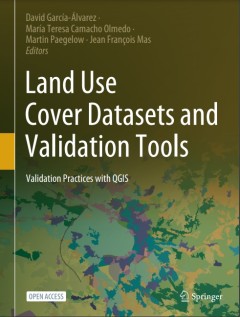
Land Use Cover Datasets and Validation Tools
This open access book represents a comprehensive review of available land-use cover data and techniques to validate and analyze this type of spatial information. The book provides the basic theory needed to understand the progress of LUCC mapping/modeling validation practice. It makes accessible to any interested user most of the research community's methods and techniques to validate LUC maps …
- Edition
- 1
- ISBN/ISSN
- 9783030909987
- Collation
- xiv; 462p; ill
- Series Title
- -
- Call Number
- 333.7313 LAN D

Mapping crisis: participation, datafication and humanitarianism in the age of…
The digital age has thrown questions of representation, participation and humanitarianism back to the fore, as machine learning, algorithms and big data centres take over the process of mapping the subjugated and subaltern. Since the rise of Google Earth in 2005, there has been an explosion in the use of mapping tools to quantify and assess the needs of those in crisis, including those affected…
- Edition
- -
- ISBN/ISSN
- 9781912250387
- Collation
- xviii, 259p.: ill
- Series Title
- -
- Call Number
- 526 MAP m

Time for mapping: cartographic temporalities
"The digital era has brought about huge transformations in the map itself, which to date have been largely conceptualised in spatial terms. Novel objects, forms, processes and approaches have emerged and pose new, pressing questions about the temporality of digital maps and contemporary mapping practices: in spite of its implicit spatiality, digital mapping is strongly grounded in time. This co…
- Edition
- -
- ISBN/ISSN
- 9781526122520
- Collation
- 140p: ill.
- Series Title
- -
- Call Number
- 526 HIN t

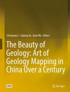
The beauty of geology: art of geology mapping in China over a century
This open access book contains a collection of rare geologic maps and figures made by Chinese geologists in the last century. Preserved in National Geological Archives of China, these artworks demonstrate the development and innovation of geological mapping technology in China in the past 100 years. The collections are highly scientific and artistic, with most of the hand-drawn maps featured wi…
- Edition
- -
- ISBN/ISSN
- 9789811337864
- Collation
- ix, 119p. : ill.
- Series Title
- -
- Call Number
- 551 BEU b
 Computer Science, Information & General Works
  Philosophy & Psychology
  Religion
  Social Sciences
  Language
  Pure Science
  Applied Sciences
  Art & Recreation
  Literature
  History & Geography